
WR-06Product sheet
Water routing
What does an hour of rain do to a valley? Routing puts a rainfall rate on every cell of the area and lets the terrain organise the flow.
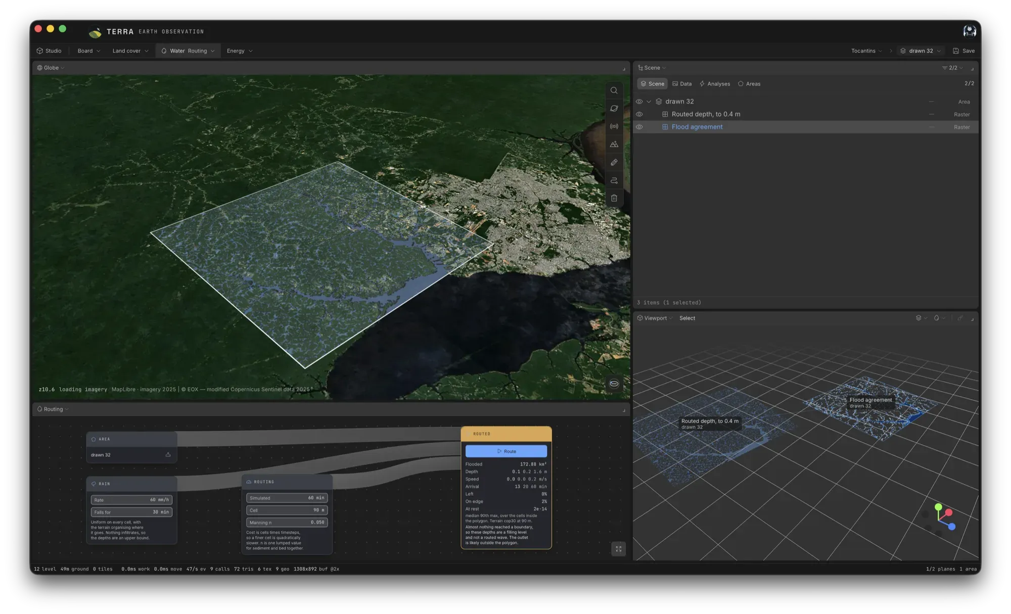
Rain, and the terrain decides
A rainfall rate and a duration are put on every cell. Nothing else steers the water: the terrain organises where it goes. What comes back is how much of the area floods, how deep the water gets, how fast it moves and when it arrives, summarised over the cells inside the area as median, 90th percentile and maximum.
The scheme, and why each piece is there
- A well-balanced shallow-water scheme (Audusse hydrostatic reconstruction): a lake at rest over an irregular bed stays at rest, and a run whose residual is not at machine noise is refused
- HLL fluxes, which keep the steep front of a flood wave rather than smearing it
- Semi-implicit Manning friction, which stays stable as the depth tends to zero at the wetting front
- Depressions filled first, and every boundary a free, one-way outflow, so water leaves the area the way the terrain sends it
A different question from the envelope
The flood envelope is static: it ranks where water would stand and never moves it. Routing moves it. The two share the same terrain chain.
!Current constraints
- Nothing infiltrates, so the depths are an upper bound.
- Rain is uniform on every cell.
- Manning's n is one lumped value for sediment and bed together.
- Cost is cells times timesteps, so a finer cell is quadratically slower.
- If almost nothing reaches a boundary, the depths are a filling level rather than a routed wave: the outlet is likely outside the polygon.